
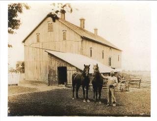
History
 Our Heritage
Antrim Township is a municipality located in Franklin County, South-Central Pennsylvania with its southern border being a part of the Mason-Dixon line. The 69.5 square mile area has a population of approximately 14800 residents. There are over 109 miles of Township roads and over 80 miles of State highways.
In 1741, the Lancaster Court of Quarter Sessions authorized the formation of Antrim Township, which at the time was a part of Lancaster County. Early Antrim included a great portion of the land that eventually became Franklin County. Its size decreased as other Boroughs and Townships were organized and incorporated. This land was part of the Penns Woods land grant from King Charles II of England in 1681 to William Penn. Ownership of the southern portion of the Penn's Woods land grant, including the area where Antrim Township is located, was in dispute between the Calvert's, who held the Charter for Maryland from King Charles the 1st, and the Penn Family. The Court of England eventually hired Charles Mason and Jeremiah Dixon to survey the disputed area which resulted in establishment of the Mason-Dixon line as the border between Maryland and Pennsylvania.
 Native American Indian tribes lived, hunted, and fished on these lands. Europeans who settled in this area were primarily Scotch-Irish (from Northern Ireland and Scotland) and German immigrants. The name "Antrim" is derived from a County in Ireland.
In the mid 1700s, several Indian attacks resulted in settlers being massacred by raiding parties. One of the most well-documented incidents occurred in 1764 when teacher Enoch Brown and ten of his scholars were killed by three Indians during the Pontiac Rebellion following the French and Indian War. One Scholar, Archie McCullough, was scalped and left for dead. He regained consciousness and survived. Enoch Brown Park is now owned by the Township and houses a monument at the common grave of Mr. Brown and his pupils.
During the Civil War Antrim saw much activity given its strategic location. On June 22, 1863, Corporal William H. Rihl, of the First New York cavalry regiment, was the first Union soldier to die in fighting north of the Mason-Dixon. He was fired upon by Confederate infantry just north of the town of Greencastle. Corporal Rihl is buried at this location and a large monument along Route 11marks the site.
 A few weeks later Confederate General Robert E. Lee and tens of thousands of his soldiers marched through Antrim enroute to what at the time was another small town; Gettysburg. Following this deadly battle the retreating Confederates again traveled through Antrim Township where skirmishes broke out. Many supplies and weapons were discarded from wagons to lighten the load.
A series of one-room schools dotted the landscape until consolidation led to the end of one room schoolhouses in Antrim. The Greencastle-Antrim School District now includes a primary school, elementary school, middle school and high school all located on a common school campus.
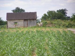
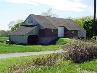
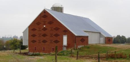
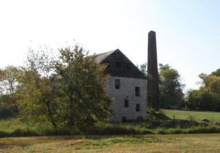
Farming was and still is the principle occupation of this area and in Pennsylvania. Industry includes Grove Worldwide Hydraulic Crane Manufacturing, World Kitchens, Jerr-Dan Roll-Back Truck Manufacturing, Strait Steel, Tarco, Beck, L & S Stone, Food Lion Distribution Center, the Franklin County Regional Intermodal Facility and dozens of smaller industries.
 Originally transportation in Antrim was by a series of roads and waterways which allowed movement of goods from farm to market. Over the years, Antrim Township has seen the improvement of what was once a toll road and later designated Pa. Route 16 (east and west) and U.S. 11 (north and south). Interstate-81 traveling north and south was constructed in the 1960's and railroads have been a important means of transportation through Antrim since 1903.
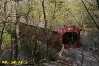
The Township insignia depicts agriculture, the Brown's Mill one-room school, now serving as a museum in the village of Kauffman Station and Martin's Mill Bridge, a covered, wooden bridge that was built in 1849. The Martin's Mill Bridge stands today and is the center of a beautiful township park located along the Conococheague Creek.
Township Government's original responsibility included construction and maintenance of rural roads and small bridges. Today, five elected Supervisors and appointed staff oversee transportation, public sewer, water, zoning, planning and other projects to promote the health, safety and welfare of the citizens of Antrim Township.
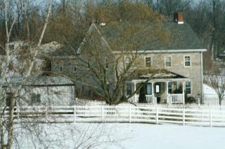
 Local History
Please visit the following links for narratives describing the importance and history of local sites along the Conococheague Creek and an account of an Indian kidnapping of the McCullough boys that occurred just west of Martin's Mill Bridge. These narratives have been reproduced here with permission from and special thanks to the authors and the Mercersburg Historical Society.
- Notes on the Early History Along the Conococheague Creek in Antrim Township, Franklin County, Pennsylvania
- John McCullough, Captive of the Indians
Click any of the pictures above to view a larger version.